
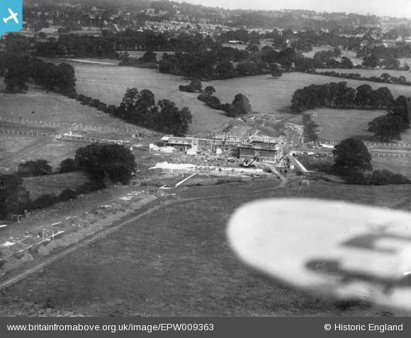
EPW009363 ENGLAND (1923). Construction of the underground station, Burnt Oak, 1923. This image has been produced from a print.
© Copyright OpenStreetMap contributors and licensed by the OpenStreetMap Foundation. 2026. Cartography is licensed as CC BY-SA.
Nearby Images (21)
EPW009363

EPW031549

EPW009347

EPW016519

EPW009345

EPW009344

EPW016517

EPW031548

EPW009682

EPW009346

EPW031583

EPW019336

EPW031550

EPW019190

EPW034858

EPW016518

EPW035548

EPW001350

EPW019191

EPW019192

EPW019338

Details
| Title | [EPW009363] Construction of the underground station, Burnt Oak, 1923. This image has been produced from a print. |
| Reference | EPW009363 |
| Date | 1923 |
| Link | |
| Place name | BURNT OAK |
| Parish | |
| District | |
| Country | ENGLAND |
| Easting / Northing | 520322, 190730 |
| Longitude / Latitude | -0.26246094163083, 51.602068186989 |
| National Grid Reference | TQ203907 |
Pins
Be the first to add a comment to this image!