
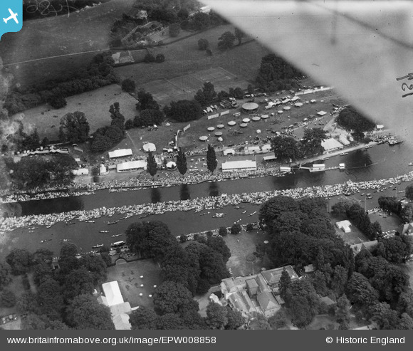
EPW008858 ENGLAND (1923). Henley-on-Thames, the approach to the finish at the Royal Regatta, 1923
© Copyright OpenStreetMap contributors and licensed by the OpenStreetMap Foundation. 2026. Cartography is licensed as CC BY-SA.
Nearby Images (38)
EPW008858

EPW008857

EPW008865

EAW044547

EAW044540

EAW024271

EPW008853

EAW044538

EAW044516

EPW008860

EPW008856

EAW044551

EAW044552

EAW044553

EPW008863

EAW044536

EAW024272

EPW008861

EAW044537

EAW024270

EAW044541

EAW044546

EAW044549

EAW044543

EAW044545

EAW044548

EAW045423

EAW024273

EAW024274

EPW035810

EAW044544

EAW024269

EAW044550

EAW044535

EAW044542

EAW044517

EAW044515

EAW045424

Details
| Title | [EPW008858] Henley-on-Thames, the approach to the finish at the Royal Regatta, 1923 |
| Reference | EPW008858 |
| Date | 7-July-1923 |
| Link | |
| Place name | HENLEY-ON-THAMES |
| Parish | HENLEY-ON-THAMES |
| District | |
| Country | ENGLAND |
| Easting / Northing | 476384, 183009 |
| Longitude / Latitude | -0.89847466853723, 51.540326792835 |
| National Grid Reference | SU764830 |
Pins
Be the first to add a comment to this image!