
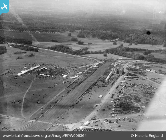
EPW006364 ENGLAND (1921). Epsom Racecourse, Epsom Downs, from the north-east, 1921
© Copyright OpenStreetMap contributors and licensed by the OpenStreetMap Foundation. 2026. Cartography is licensed as CC BY-SA.
Nearby Images (23)
EPW006364

EPW006382

EPW027459

EPW007900

EPW006400

EPW006384

EPW007653

EPW006441

EPW025147

EAW049845

EAW002166

EAW002167

EPW027457

EAW000991

EAW017627

EAW036447

EPW027461

EAW002165

EPW006391

EPW025140

EPW035517

EAW049499

EPW006387

Details
| Title | [EPW006364] Epsom Racecourse, Epsom Downs, from the north-east, 1921 |
| Reference | EPW006364 |
| Date | 31-May-1921 |
| Link | |
| Place name | EPSOM DOWNS |
| Parish | |
| District | |
| Country | ENGLAND |
| Easting / Northing | 522109, 158428 |
| Longitude / Latitude | -0.24782339239131, 51.311342194627 |
| National Grid Reference | TQ221584 |
Pins
User Comment Contributions
During Derby Week |

Eliz |
Tuesday 19th of February 2013 10:23:59 PM |