
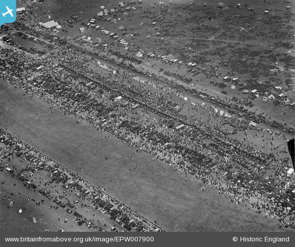
EPW007900 ENGLAND (1922). Epsom Racecourse, Epsom Downs, 1922
© Copyright OpenStreetMap contributors and licensed by the OpenStreetMap Foundation. 2026. Cartography is licensed as CC BY-SA.
Nearby Images (21)
EPW007900

EPW006364

EPW006382

EPW007653

EPW027459

EPW027457

EPW025147

EAW000991

EAW002167

EPW006400

EPW006384

EAW017627

EAW002166

EAW002165

EPW006441

EPW025144

EAW049845

EPW006391

EPW025158

EAW036447

EAW049499

Details
| Title | [EPW007900] Epsom Racecourse, Epsom Downs, 1922 |
| Reference | EPW007900 |
| Date | May-1922 |
| Link | |
| Place name | EPSOM DOWNS |
| Parish | |
| District | |
| Country | ENGLAND |
| Easting / Northing | 522060, 158473 |
| Longitude / Latitude | -0.24851074996089, 51.311757195871 |
| National Grid Reference | TQ221585 |
Pins
Be the first to add a comment to this image!