
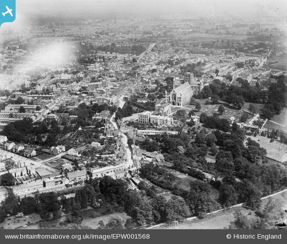
EPW001568 ENGLAND (1920). St Alban's Cathedral and the town centre, St Alban's, 1920
© Copyright OpenStreetMap contributors and licensed by the OpenStreetMap Foundation. 2026. Cartography is licensed as CC BY-SA.
Nearby Images (44)
EPW001568

EAW025077

EAW025079

EPW001251

EAW025084

EAW025082

EAW025080

EAW025083

EAW025078

EPW001253

EAW015585

EAW048026

EPW005305

EAW025081

EAW011299

EPW019242

EPW019239

EAW015583

EAW015587

EPW047105

EAW011300

EAW015586

EAW027917

EPW025394

EAW048025

EPW047107

EPW047112

EAW015584

EPW001258

EPW047109

EPW001250

EPW005304

EPW017812

EPW047111

EPW047106

EAW048027

EPW001255

EPW017813

EAW030945

EPW019241

EPW017814

EPW047110

EAW027918

EAW030944

Details
| Title | [EPW001568] St Alban's Cathedral and the town centre, St Alban's, 1920 |
| Reference | EPW001568 |
| Date | June-1920 |
| Link | |
| Place name | ST ALBANS |
| Parish | |
| District | |
| Country | ENGLAND |
| Easting / Northing | 514353, 207145 |
| Longitude / Latitude | -0.34324152758272, 51.750858054459 |
| National Grid Reference | TL144071 |
Pins

Henrythefifith |
Wednesday 4th of July 2012 09:42:27 AM |
User Comment Contributions
Sorry, also St Albans ABBEY, not Cathedral |
G Shortell |
Friday 6th of July 2012 04:51:49 PM |
CITY centre, please! |
G Shortell |
Friday 6th of July 2012 04:48:53 PM |