
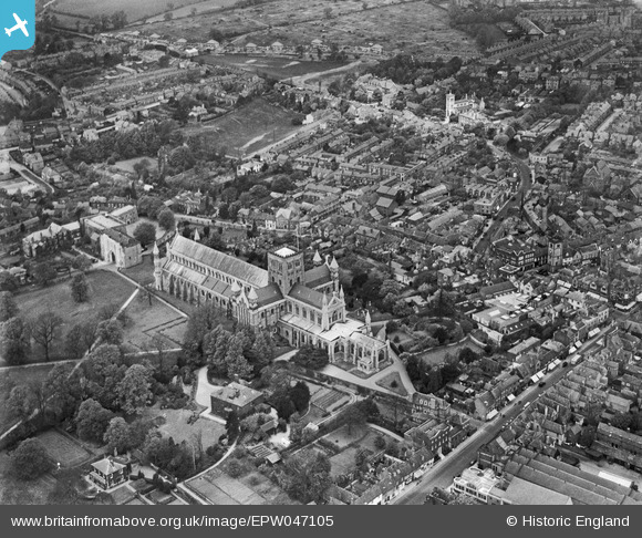
EPW047105 ENGLAND (1935). St Albans Cathedral and the city centre, St Albans, 1935
© Copyright OpenStreetMap contributors and licensed by the OpenStreetMap Foundation. 2026. Cartography is licensed as CC BY-SA.
Nearby Images (48)
EPW047105

EPW047107

EPW047112

EAW048027

EPW047109

EPW005305

EPW047106

EAW015585

EAW015587

EAW015584

EPW005304

EAW025078

EPW025394

EPW047108

EPW019239

EPW001251

EPW019242

EAW015583

EPW047111

EAW011299

EAW030954

EAW048026

EPW017813

EAW015586

EAW027917

EPW001255

EAW025079

EPW001258

EAW015583A

EPW017812

EPW019241

EPW047110

EAW025083

EPW001253

EPW017814

EAW025084

EAW011300

EPW001568

EAW015569

EAW025077

EAW048025

EAW015570

EAW025080

EAW027918

EAW000662

EPW001250

EAW025082

EPW025393

Details
| Title | [EPW047105] St Albans Cathedral and the city centre, St Albans, 1935 |
| Reference | EPW047105 |
| Date | May-1935 |
| Link | |
| Place name | ST ALBANS |
| Parish | |
| District | |
| Country | ENGLAND |
| Easting / Northing | 514522, 207146 |
| Longitude / Latitude | -0.34079381446002, 51.750832512879 |
| National Grid Reference | TL145071 |
Pins
Be the first to add a comment to this image!