
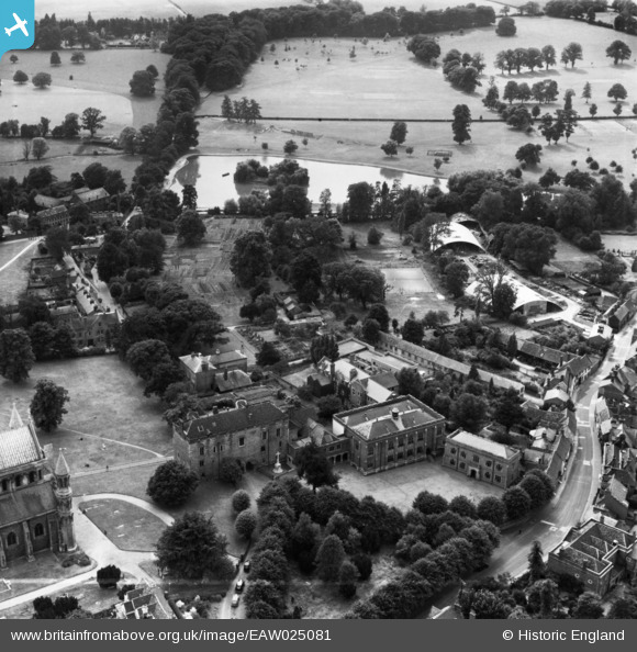
EAW025081 ENGLAND (1949). St Albans School, St Albans, 1949. This image has been produced from a print marked by Aerofilms Ltd for photo editing.
© Copyright OpenStreetMap contributors and licensed by the OpenStreetMap Foundation. 2026. Cartography is licensed as CC BY-SA.
Nearby Images (30)
EAW025081

EAW025082

EAW025080

EAW025077

EAW030945

EAW025084

EPW001568

EPW001253

EAW025079

EAW030944

EPW001250

EPW001251

EAW011299

EAW011300

EAW048025

EAW015585

EPW019242

EAW015589

EAW025083

EPW019239

EAW027917

EAW015586

EAW015583

EAW025078

EAW015587

EPW005305

EPW025394

EAW048026

EAW003453

EAW027918

Details
| Title | [EAW025081] St Albans School, St Albans, 1949. This image has been produced from a print marked by Aerofilms Ltd for photo editing. |
| Reference | EAW025081 |
| Date | 22-July-1949 |
| Link | |
| Place name | ST ALBANS |
| Parish | |
| District | |
| Country | ENGLAND |
| Easting / Northing | 514263, 207055 |
| Longitude / Latitude | -0.34457445113961, 51.750067469461 |
| National Grid Reference | TL143071 |
Pins
Be the first to add a comment to this image!