
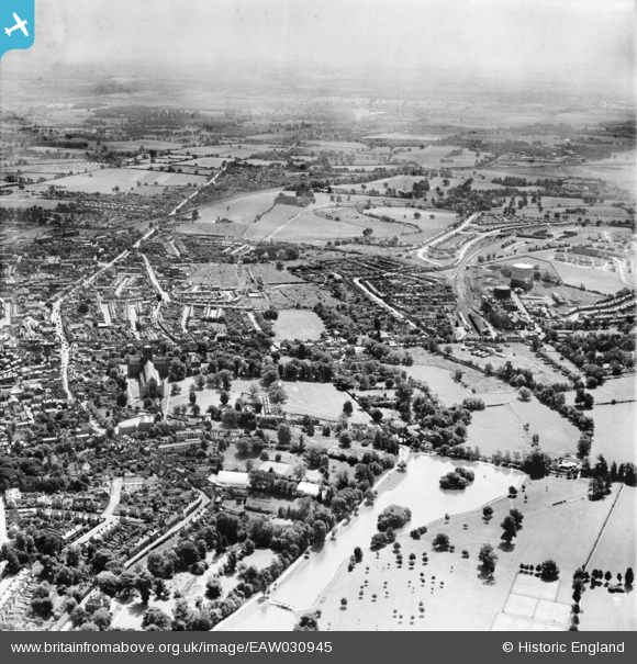
EAW030945 ENGLAND (1950). The Lake and the area around Abbey Mill and Sopwell Nunnery, St Albans, from the north-west, 1950
© Copyright OpenStreetMap contributors and licensed by the OpenStreetMap Foundation. 2026. Cartography is licensed as CC BY-SA.
Nearby Images (14)
EAW030945

EAW030944

EAW025081

EAW015589

EAW025082

EAW025080

EAW003453

EAW025077

EAW025084

EPW001250

EPW001568

EPW001253

EAW025079

EAW025083

Details
| Title | [EAW030945] The Lake and the area around Abbey Mill and Sopwell Nunnery, St Albans, from the north-west, 1950 |
| Reference | EAW030945 |
| Date | 13-July-1950 |
| Link | |
| Place name | ST ALBANS |
| Parish | |
| District | |
| Country | ENGLAND |
| Easting / Northing | 514177, 206985 |
| Longitude / Latitude | -0.34584283560001, 51.749455820946 |
| National Grid Reference | TL142070 |
Pins
Be the first to add a comment to this image!