
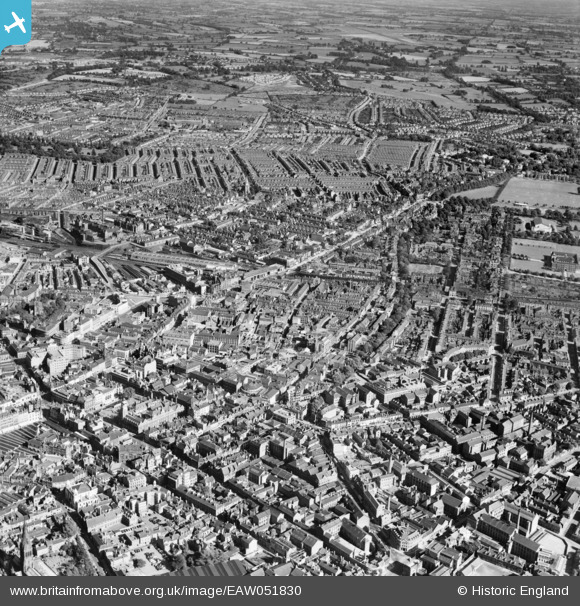
EAW051830 ENGLAND (1953). The city centre, Leicester, from the west, 1953
© Copyright OpenStreetMap contributors and licensed by the OpenStreetMap Foundation. 2026. Cartography is licensed as CC BY-SA.
Nearby Images (23)
EAW051830

EPW020818

EPW020825

EPW018415

EPW020814

EPW018461

EPW020826

EPW020816

EPW020815

EPW020817

EAW024241

EPW055010

EAW051828

EPW020819

EPW020822

EPW020824

EPW018420

EPW008477

EPW008476

EPW047868

EPW047642

EPW008475

EPW018421

Details
| Title | [EAW051830] The city centre, Leicester, from the west, 1953 |
| Reference | EAW051830 |
| Date | 1-September-1953 |
| Link | |
| Place name | LEICESTER |
| Parish | |
| District | |
| Country | ENGLAND |
| Easting / Northing | 458700, 304136 |
| Longitude / Latitude | -1.1325966153353, 52.631448210639 |
| National Grid Reference | SK587041 |
Pins
Be the first to add a comment to this image!