
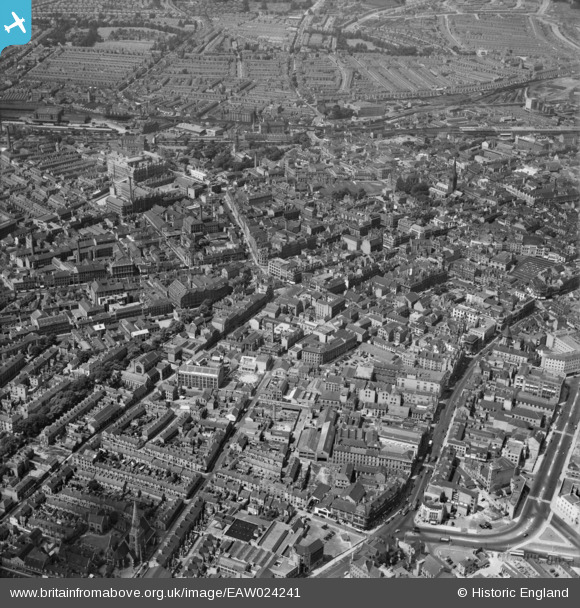
EAW024241 ENGLAND (1949). The city centre, Leicester, 1949
© Copyright OpenStreetMap contributors and licensed by the OpenStreetMap Foundation. 2026. Cartography is licensed as CC BY-SA.
Nearby Images (23)
EAW024241

EPW020822

EPW020819

EPW020816

EPW018461

EPW020817

EPW020815

EPW020824

EPW018415

EPW020825

EAW051828

EPW020818

EAW051830

EPW020814

EPW020826

EPW047868

EPW055010

EPW018421

EPW020892

EPW018436

EPW061211

EPW055002

EPW047642

Details
| Title | [EAW024241] The city centre, Leicester, 1949 |
| Reference | EAW024241 |
| Date | 27-June-1949 |
| Link | |
| Place name | LEICESTER |
| Parish | |
| District | |
| Country | ENGLAND |
| Easting / Northing | 458809, 304171 |
| Longitude / Latitude | -1.130979901867, 52.631751050083 |
| National Grid Reference | SK588042 |


