
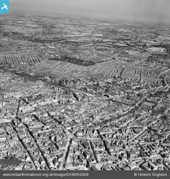
EAW051828 ENGLAND (1953). The city, Leicester, from the west, 1953
© Copyright OpenStreetMap contributors and licensed by the OpenStreetMap Foundation. 2026. Cartography is licensed as CC BY-SA.
Nearby Images (17)
EAW051828

EPW018461

EAW024241

EPW020816

EPW018415

EPW020818

EAW051830

EPW020822

EPW020825

EPW020815

EPW020819

EPW020817

EPW020814

EPW020824

EPW020826

EPW055010

EPW047868

Details
| Title | [EAW051828] The city, Leicester, from the west, 1953 |
| Reference | EAW051828 |
| Date | 1-September-1953 |
| Link | |
| Place name | LEICESTER |
| Parish | |
| District | |
| Country | ENGLAND |
| Easting / Northing | 458806, 304069 |
| Longitude / Latitude | -1.1310423937256, 52.630834421467 |
| National Grid Reference | SK588041 |
Pins

Jim Mitcho |
Friday 13th of February 2015 05:49:47 PM | |
|
Jim Mitcho |
Friday 13th of February 2015 05:45:08 PM | |
|
Jim Mitcho |
Friday 13th of February 2015 05:39:19 PM | |
|
Jim Mitcho |
Friday 13th of February 2015 05:38:15 PM | |
|
Jim Mitcho |
Friday 13th of February 2015 05:36:27 PM | |
|
Jim Mitcho |
Friday 13th of February 2015 05:25:16 PM | |
On the Midland Main Line between St Pancras and Derby/Nottingham. |
John W |
Friday 16th of December 2016 09:22:57 PM |
|
Jim Mitcho |
Friday 13th of February 2015 05:22:29 PM |