
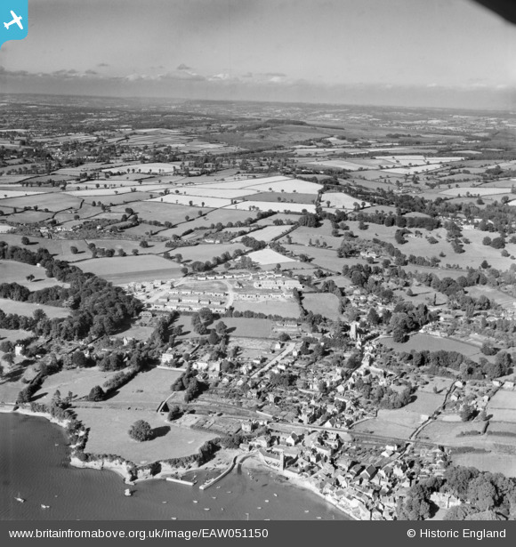
EAW051150 ENGLAND (1953). The village and the surrounding countryside, Lympstone, from the south-west, 1953
© Copyright OpenStreetMap contributors and licensed by the OpenStreetMap Foundation. 2026. Cartography is licensed as CC BY-SA.
Nearby Images (5)
EAW051150

EAW051149

EAW015035

EAW051148

EAW015034

Details
| Title | [EAW051150] The village and the surrounding countryside, Lympstone, from the south-west, 1953 |
| Reference | EAW051150 |
| Date | 10-August-1953 |
| Link | |
| Place name | LYMPSTONE |
| Parish | LYMPSTONE |
| District | |
| Country | ENGLAND |
| Easting / Northing | 299028, 84245 |
| Longitude / Latitude | -3.428373931086, 50.648546711787 |
| National Grid Reference | SX990842 |
Pins
Be the first to add a comment to this image!