
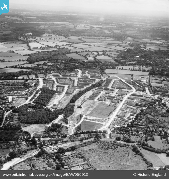
EAW050913 ENGLAND (1953). New housing around Winfield Road and Northgate Avenue, Crawley, from the north, 1953
© Copyright OpenStreetMap contributors and licensed by the OpenStreetMap Foundation. 2025. Cartography is licensed as CC BY-SA.
Nearby Images (5)
EAW050913

EAW044440

EAW044434

EAW041930

EAW051199

Details
| Title | [EAW050913] New housing around Winfield Road and Northgate Avenue, Crawley, from the north, 1953 |
| Reference | EAW050913 |
| Date | 27-July-1953 |
| Link | |
| Place name | CRAWLEY |
| Parish | |
| District | |
| Country | ENGLAND |
| Easting / Northing | 527771, 137608 |
| Longitude / Latitude | -0.17404144448433, 51.122961315031 |
| National Grid Reference | TQ278376 |
Pins
Be the first to add a comment to this image!