
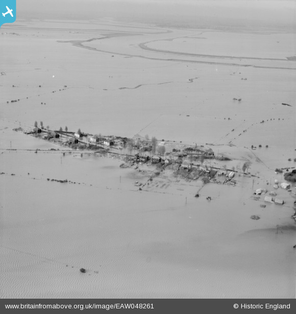
EAW048261 ENGLAND (1953). Extensive flooding around Churchend, Foulness Island, 1953
© Copyright OpenStreetMap contributors and licensed by the OpenStreetMap Foundation. 2026. Cartography is licensed as CC BY-SA.
Nearby Images (4)
EAW048261

EAW048251

EAW048254

EAW048255

Details
| Title | [EAW048261] Extensive flooding around Churchend, Foulness Island, 1953 |
| Reference | EAW048261 |
| Date | 2-February-1953 |
| Link | |
| Place name | FOULNESS ISLAND |
| Parish | FOULNESS |
| District | |
| Country | ENGLAND |
| Easting / Northing | 600300, 192880 |
| Longitude / Latitude | 0.89244051117275, 51.598618575442 |
| National Grid Reference | TR003929 |
Pins
Be the first to add a comment to this image!