
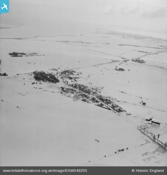
EAW048255 ENGLAND (1953). Extensive flooding around Churchend, Foulness Island, from the south-west, 1953
© Copyright OpenStreetMap contributors and licensed by the OpenStreetMap Foundation. 2026. Cartography is licensed as CC BY-SA.
Nearby Images (3)
EAW048255

EAW048251

EAW048261

Details
| Title | [EAW048255] Extensive flooding around Churchend, Foulness Island, from the south-west, 1953 |
| Reference | EAW048255 |
| Date | 2-February-1953 |
| Link | |
| Place name | FOULNESS ISLAND |
| Parish | FOULNESS |
| District | |
| Country | ENGLAND |
| Easting / Northing | 600130, 192646 |
| Longitude / Latitude | 0.88985548913608, 51.596577470074 |
| National Grid Reference | TR001926 |
Pins

redmist |
Thursday 8th of February 2024 09:59:54 PM |