
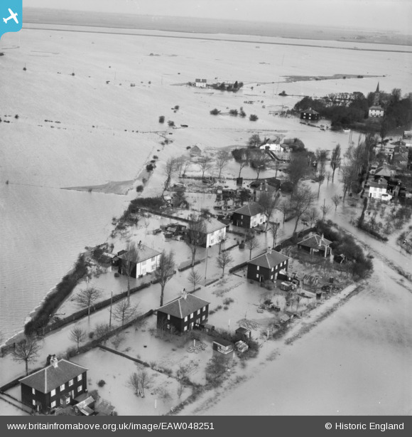
EAW048251 ENGLAND (1953). Flooding at Churchend, Foulness Island, from the south-east, 1953
© Copyright OpenStreetMap contributors and licensed by the OpenStreetMap Foundation. 2026. Cartography is licensed as CC BY-SA.
Nearby Images (3)
EAW048251

EAW048255

EAW048261

Details
| Title | [EAW048251] Flooding at Churchend, Foulness Island, from the south-east, 1953 |
| Reference | EAW048251 |
| Date | 2-February-1953 |
| Link | |
| Place name | FOULNESS ISLAND |
| Parish | FOULNESS |
| District | |
| Country | ENGLAND |
| Easting / Northing | 600262, 192680 |
| Longitude / Latitude | 0.89177835033753, 51.596835908345 |
| National Grid Reference | TR003927 |
Pins
Be the first to add a comment to this image!