
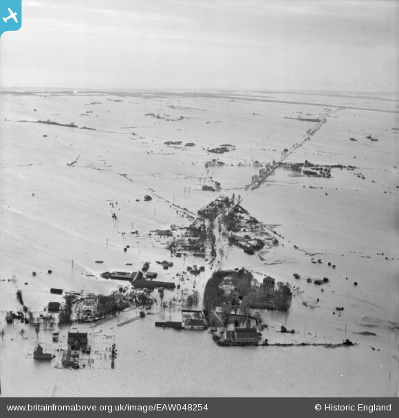
EAW048254 ENGLAND (1953). Extensive flooding around Churchend, Foulness Island, from the north, 1953
© Copyright OpenStreetMap contributors and licensed by the OpenStreetMap Foundation. 2026. Cartography is licensed as CC BY-SA.
Nearby Images (5)
EAW048254

EAW048253

EAW048252

EAW048257

EAW048261

Details
| Title | [EAW048254] Extensive flooding around Churchend, Foulness Island, from the north, 1953 |
| Reference | EAW048254 |
| Date | 2-February-1953 |
| Link | |
| Place name | FOULNESS ISLAND |
| Parish | FOULNESS |
| District | |
| Country | ENGLAND |
| Easting / Northing | 600442, 193108 |
| Longitude / Latitude | 0.89461853997468, 51.600615699854 |
| National Grid Reference | TR004931 |
Pins
Be the first to add a comment to this image!