
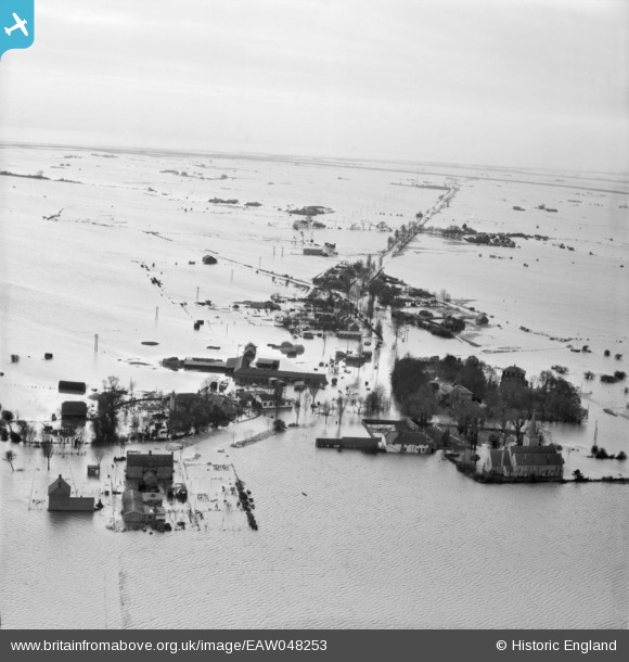
EAW048253 ENGLAND (1953). Extensive flooding around Churchend, Foulness Island, from the north, 1953
© Copyright OpenStreetMap contributors and licensed by the OpenStreetMap Foundation. 2026. Cartography is licensed as CC BY-SA.
Nearby Images (4)
EAW048253

EAW048252

EAW048254

EAW048257

Details
| Title | [EAW048253] Extensive flooding around Churchend, Foulness Island, from the north, 1953 |
| Reference | EAW048253 |
| Date | 2-February-1953 |
| Link | |
| Place name | FOULNESS ISLAND |
| Parish | FOULNESS |
| District | |
| Country | ENGLAND |
| Easting / Northing | 600478, 193171 |
| Longitude / Latitude | 0.8951737176512, 51.60116868128 |
| National Grid Reference | TR005932 |
Pins
Be the first to add a comment to this image!