
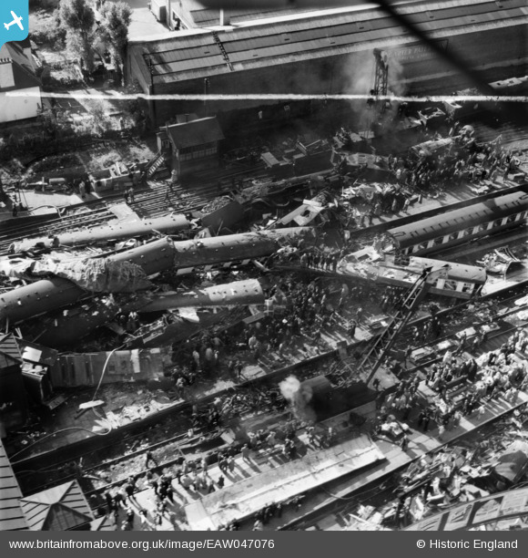
EAW047076 ENGLAND (1952). The aftermath of the Harrow and Wealdstone rail crash, Wealdstone, 1952. This image was marked by Aerofilms Ltd for photo editing.
© Copyright OpenStreetMap contributors and licensed by the OpenStreetMap Foundation. 2026. Cartography is licensed as CC BY-SA.
Nearby Images (23)
EAW047076

EAW047079

EAW047078

EAW047077

EAW047080

EAW047073

EAW047072

EAW047085

EAW047075

EAW047082

EAW047084

EAW047083

EAW047069

EAW047067

EAW047065

EAW047066

EAW047081

EAW047074

EPW053686

EAW047068

EAW047070

EPW005359

EAW047071

Details
| Title | [EAW047076] The aftermath of the Harrow and Wealdstone rail crash, Wealdstone, 1952. This image was marked by Aerofilms Ltd for photo editing. |
| Reference | EAW047076 |
| Date | 8-October-1952 |
| Link | |
| Place name | WEALDSTONE |
| Parish | |
| District | |
| Country | ENGLAND |
| Easting / Northing | 515426, 189476 |
| Longitude / Latitude | -0.33354260860281, 51.591821493981 |
| National Grid Reference | TQ154895 |
Pins
Be the first to add a comment to this image!