
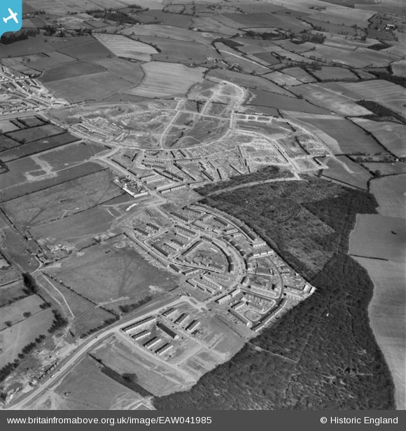
EAW041985 ENGLAND (1952). Development of Monkswood and Bedwell, Stevenage, 1952
© Copyright OpenStreetMap contributors and licensed by the OpenStreetMap Foundation. 2026. Cartography is licensed as CC BY-SA.
Nearby Images (9)
EAW041985

EAW041980

EAW047269

EAW047262

EAW047263

EAW047261

EAW047265

EAW047270

EAW047268

Details
| Title | [EAW041985] Development of Monkswood and Bedwell, Stevenage, 1952 |
| Reference | EAW041985 |
| Date | 14-March-1952 |
| Link | |
| Place name | STEVENAGE |
| Parish | |
| District | |
| Country | ENGLAND |
| Easting / Northing | 524546, 223755 |
| Longitude / Latitude | -0.1896642354692, 51.897967249685 |
| National Grid Reference | TL245238 |
Pins

Hugh Madgin |
Wednesday 18th of June 2014 10:43:18 PM |