
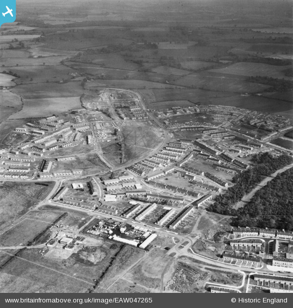
EAW047265 ENGLAND (1952). The residential areas at Whomerley Wood and Bedwell North under construction, Bedwell, from the south-west, 1952
© Copyright OpenStreetMap contributors and licensed by the OpenStreetMap Foundation. 2026. Cartography is licensed as CC BY-SA.
Nearby Images (11)
EAW047265

EAW047263

EAW047262

EAW041980

EAW047260

EAW053198

EAW053196

EAW053197

EAW047261

EAW041985

EAW032037

Details
| Title | [EAW047265] The residential areas at Whomerley Wood and Bedwell North under construction, Bedwell, from the south-west, 1952 |
| Reference | EAW047265 |
| Date | 15-October-1952 |
| Link | |
| Place name | BEDWELL |
| Parish | |
| District | |
| Country | ENGLAND |
| Easting / Northing | 524492, 223974 |
| Longitude / Latitude | -0.19036962700109, 51.899947559873 |
| National Grid Reference | TL245240 |
Pins
Be the first to add a comment to this image!