
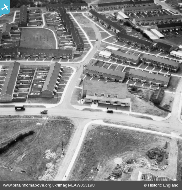
EAW053198 ENGLAND (1954). St Andrew's Church on Bedwell Crescent, Stevenage, 1954
© Copyright OpenStreetMap contributors and licensed by the OpenStreetMap Foundation. 2026. Cartography is licensed as CC BY-SA.
Nearby Images (9)
EAW053198

EAW053197

EAW053196

EAW047260

EAW047265

EAW047264

EAW047262

EAW047263

EAW047261

Details
| Title | [EAW053198] St Andrew's Church on Bedwell Crescent, Stevenage, 1954 |
| Reference | EAW053198 |
| Date | 10-March-1954 |
| Link | |
| Place name | STEVENAGE |
| Parish | |
| District | |
| Country | ENGLAND |
| Easting / Northing | 524583, 224114 |
| Longitude / Latitude | -0.18899694491457, 51.901185453872 |
| National Grid Reference | TL246241 |
Pins

Billy Turner |
Wednesday 9th of November 2016 04:17:52 PM | |
|
Billy Turner |
Wednesday 9th of November 2016 04:04:37 PM | |
|
Billy Turner |
Tuesday 8th of November 2016 08:38:34 PM |


