
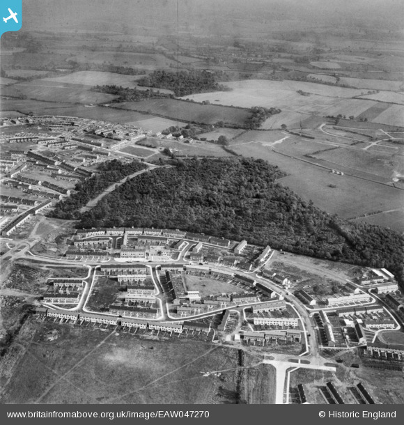
EAW047270 ENGLAND (1952). The residential area at Monks Wood alongside Whomerley Wood, Bedwell, from the west, 1952
© Copyright OpenStreetMap contributors and licensed by the OpenStreetMap Foundation. 2026. Cartography is licensed as CC BY-SA.
Nearby Images (10)
EAW047270

EAW047268

EAW047266

EAW047271

EAW047267

EAW047274

EAW047272

EAW047273

EAW047269

EAW041985

Details
| Title | [EAW047270] The residential area at Monks Wood alongside Whomerley Wood, Bedwell, from the west, 1952 |
| Reference | EAW047270 |
| Date | 15-October-1952 |
| Link | |
| Place name | BEDWELL |
| Parish | |
| District | |
| Country | ENGLAND |
| Easting / Northing | 524359, 223558 |
| Longitude / Latitude | -0.1924519794841, 51.89623849753 |
| National Grid Reference | TL244236 |
Pins

Hugh Madgin |
Wednesday 8th of October 2014 02:12:07 PM | |
|
Hugh Madgin |
Wednesday 8th of October 2014 02:11:01 PM |