
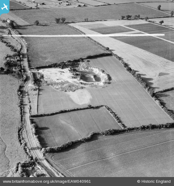
EAW040961 ENGLAND (1951). A gravel pit off the A1060, Roxwell, 1951. This image was marked by Aerofilms Ltd for photo editing.
© Copyright OpenStreetMap contributors and licensed by the OpenStreetMap Foundation. 2026. Cartography is licensed as CC BY-SA.
Nearby Images (8)
EAW040961

EAW040966

EAW040963

EAW040964

EAW040968

EAW040962

EAW040965

EAW040967

Details
| Title | [EAW040961] A gravel pit off the A1060, Roxwell, 1951. This image was marked by Aerofilms Ltd for photo editing. |
| Reference | EAW040961 |
| Date | 17-October-1951 |
| Link | |
| Place name | ROXWELL |
| Parish | ROXWELL |
| District | |
| Country | ENGLAND |
| Easting / Northing | 565646, 208518 |
| Longitude / Latitude | 0.39995693206536, 51.750375988252 |
| National Grid Reference | TL656085 |
Pins

TomRobin |
Friday 6th of June 2014 10:39:04 PM | |
|
TomRobin |
Friday 6th of June 2014 10:37:42 PM | |
That's a geat "spot" TomRobin, thanks! We'll update the catalogue and post your new location data here in due course. Yours, Katy Britain from Above Cataloguing Team Leader |
Katy Whitaker |
Friday 27th of June 2014 05:13:26 PM |
