
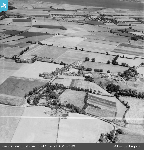
EAW030569 ENGLAND (1950). The village and surrounding countryside, West Tilbury, 1950. This image was marked by Aerofilms Ltd for photo editing.
© Copyright OpenStreetMap contributors and licensed by the OpenStreetMap Foundation. 2025. Cartography is licensed as CC BY-SA.
Nearby Images (6)
EAW030569

EAW030570

EAW030571

EAW030572

EAW030568

EAW030573

Details
| Title | [EAW030569] The village and surrounding countryside, West Tilbury, 1950. This image was marked by Aerofilms Ltd for photo editing. |
| Reference | EAW030569 |
| Date | 28-June-1950 |
| Link | |
| Place name | WEST TILBURY |
| Parish | |
| District | |
| Country | ENGLAND |
| Easting / Northing | 566048, 177962 |
| Longitude / Latitude | 0.39129813451758, 51.475728187909 |
| National Grid Reference | TQ660780 |
Pins
 Matt Aldred edob.mattaldred.com |
Saturday 20th of February 2021 03:27:05 PM | |
 redmist |
Monday 27th of July 2020 04:58:13 PM | |
redmist |
Monday 27th of July 2020 04:57:42 PM | |
David Emery |
Saturday 15th of November 2014 05:23:08 PM |