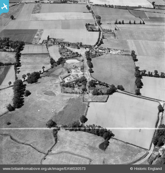
EAW030573 ENGLAND (1950). The village, West Tilbury, 1950. This image was marked by Aerofilms Ltd for photo editing.
© Copyright OpenStreetMap contributors and licensed by the OpenStreetMap Foundation. 2025. Cartography is licensed as CC BY-SA.
Nearby Images (5)
Details
| Title | [EAW030573] The village, West Tilbury, 1950. This image was marked by Aerofilms Ltd for photo editing. |
| Reference | EAW030573 |
| Date | 28-June-1950 |
| Link | |
| Place name | WEST TILBURY |
| Parish | |
| District | |
| Country | ENGLAND |
| Easting / Northing | 566104, 177743 |
| Longitude / Latitude | 0.39200087629425, 51.473744097186 |
| National Grid Reference | TQ661777 |


![[EAW030573] The village, West Tilbury, 1950. This image was marked by Aerofilms Ltd for photo editing.](http://britainfromabove.org.uk/sites/all/libraries/aerofilms-images/public/100x100/EAW/030/EAW030573.jpg)
![[EAW030568] St James's Church and the village, West Tilbury, 1950. This image was marked by Aerofilms Ltd for photo editing.](http://britainfromabove.org.uk/sites/all/libraries/aerofilms-images/public/100x100/EAW/030/EAW030568.jpg)
![[EAW030572] The village, West Tilbury, 1950. This image was marked by Aerofilms Ltd for photo editing.](http://britainfromabove.org.uk/sites/all/libraries/aerofilms-images/public/100x100/EAW/030/EAW030572.jpg)
![[EAW030571] The Green and the village, West Tilbury, 1950. This image was marked by Aerofilms Ltd for photo editing.](http://britainfromabove.org.uk/sites/all/libraries/aerofilms-images/public/100x100/EAW/030/EAW030571.jpg)
![[EAW030569] The village and surrounding countryside, West Tilbury, 1950. This image was marked by Aerofilms Ltd for photo editing.](http://britainfromabove.org.uk/sites/all/libraries/aerofilms-images/public/100x100/EAW/030/EAW030569.jpg)
