
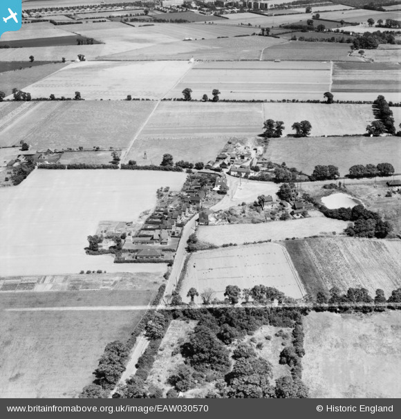
EAW030570 ENGLAND (1950). Rectory Road and The Green, West Tilbury, 1950. This image was marked by Aerofilms Ltd for photo editing.
© Copyright OpenStreetMap contributors and licensed by the OpenStreetMap Foundation. 2025. Cartography is licensed as CC BY-SA.
Nearby Images (5)
EAW030570

EAW030569

EAW030571

EAW030572

EAW030568

Details
| Title | [EAW030570] Rectory Road and The Green, West Tilbury, 1950. This image was marked by Aerofilms Ltd for photo editing. |
| Reference | EAW030570 |
| Date | 28-June-1950 |
| Link | |
| Place name | WEST TILBURY |
| Parish | |
| District | |
| Country | ENGLAND |
| Easting / Northing | 566022, 177999 |
| Longitude / Latitude | 0.39094144243975, 51.476068253513 |
| National Grid Reference | TQ660780 |
Pins

redmist |
Monday 27th of July 2020 05:02:25 PM |