
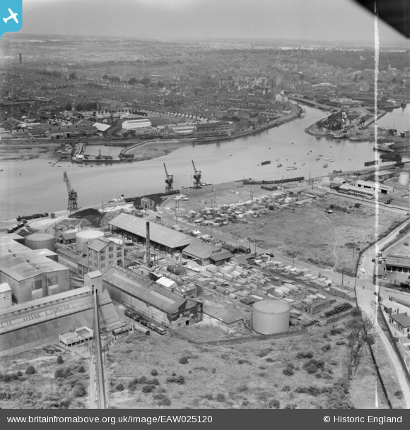
EAW025120 ENGLAND (1949). Gabriel, Wade and English Timber Yard, the River Orwell and the town, Ipswich, from the south-east, 1949. This image was marked by Aerofilms Ltd for photo editing.
© Copyright OpenStreetMap contributors and licensed by the OpenStreetMap Foundation. 2026. Cartography is licensed as CC BY-SA.
Nearby Images (27)
EAW025120

EAW025116

EAW025122

EAW025119

EPW032847

EPW041402

EAW025123

EAW025117

EAW045633

EAW045631

EAW045628

EAW025121

EAW045629

EAW045630

EPW032846

EAW045636

EPW032839

EPW032831

EAW045632

EAW025118

EPW032838

EAW045635

EAW045634

EPW043657

EPW032841

EAW045637

EPW032861

Details
| Title | [EAW025120] Gabriel, Wade and English Timber Yard, the River Orwell and the town, Ipswich, from the south-east, 1949. This image was marked by Aerofilms Ltd for photo editing. |
| Reference | EAW025120 |
| Date | 22-July-1949 |
| Link | |
| Place name | IPSWICH |
| Parish | |
| District | |
| Country | ENGLAND |
| Easting / Northing | 617026, 242753 |
| Longitude / Latitude | 1.1648452916802, 52.040204449245 |
| National Grid Reference | TM170428 |
Pins
Be the first to add a comment to this image!