
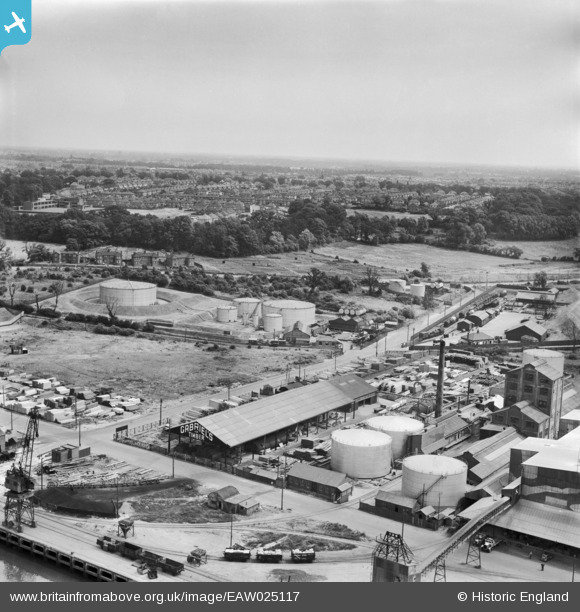
EAW025117 ENGLAND (1949). Gabriel, Wade and English Timber Yard, Greenwich Road and environs, Ipswich, from the west, 1949
© Copyright OpenStreetMap contributors and licensed by the OpenStreetMap Foundation. 2026. Cartography is licensed as CC BY-SA.
Nearby Images (28)
EAW025117

EAW025122

EPW041402

EAW025116

EAW025120

EAW025121

EPW032839

EAW025123

EAW025119

EPW032847

EAW045633

EAW045628

EPW043657

EPW043661

EPW032841

EAW045631

EAW045629

EPW043658

EPW032846

EAW045636

EAW045630

EPW043659

EAW045632

EPW032860

EPW043660

EPW043663

EPW032831

EPW032854

Details
| Title | [EAW025117] Gabriel, Wade and English Timber Yard, Greenwich Road and environs, Ipswich, from the west, 1949 |
| Reference | EAW025117 |
| Date | 22-July-1949 |
| Link | |
| Place name | IPSWICH |
| Parish | |
| District | |
| Country | ENGLAND |
| Easting / Northing | 616940, 242806 |
| Longitude / Latitude | 1.1636268656126, 52.040713934972 |
| National Grid Reference | TM169428 |
Pins
Be the first to add a comment to this image!