
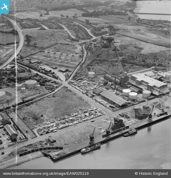
EAW025119 ENGLAND (1949). Gabriel, Wade and English Timber Yard, Greenwich Road and environs, Ipswich, 1949. This image was marked by Aerofilms Ltd for photo editing.
© Copyright OpenStreetMap contributors and licensed by the OpenStreetMap Foundation. 2026. Cartography is licensed as CC BY-SA.
Nearby Images (24)
EAW025119

EAW025116

EAW025120

EPW032847

EAW025122

EAW025123

EAW025117

EAW025121

EPW041402

EAW045633

EAW045631

EAW045628

EPW032831

EAW045629

EAW045630

EPW032846

EAW045636

EPW032839

EAW045632

EAW025118

EPW032841

EPW032861

EAW045635

EPW032862

Details
| Title | [EAW025119] Gabriel, Wade and English Timber Yard, Greenwich Road and environs, Ipswich, 1949. This image was marked by Aerofilms Ltd for photo editing. |
| Reference | EAW025119 |
| Date | 22-July-1949 |
| Link | |
| Place name | IPSWICH |
| Parish | |
| District | |
| Country | ENGLAND |
| Easting / Northing | 617062, 242775 |
| Longitude / Latitude | 1.1653833715733, 52.040387872529 |
| National Grid Reference | TM171428 |
Pins

Matt Aldred edob.mattaldred.com |
Tuesday 7th of July 2026 04:01:17 PM |