
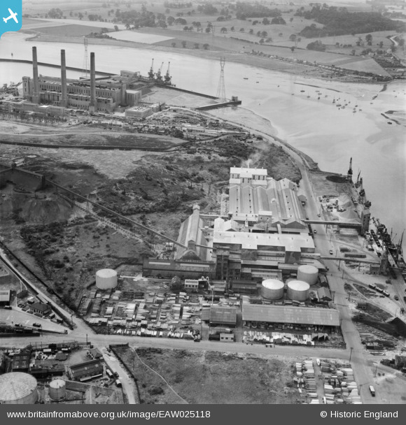
EAW025118 ENGLAND (1949). orks on Cliff Quay and the Cliff Quay Generating Station, Ipswich, 1949
© Copyright OpenStreetMap contributors and licensed by the OpenStreetMap Foundation. 2026. Cartography is licensed as CC BY-SA.
Nearby Images (28)
EAW025118

EAW045632

EAW045635

EAW045634

EAW045637

EAW045636

EPW032846

EAW045628

EAW045629

EAW045630

EAW045633

EAW045631

EPW032838

EPW041402

EPW043660

EPW043663

EPW032839

EPW043659

EAW025120

EPW032854

EPW043658

EPW043657

EAW025116

EAW025122

EPW043662

EPW032831

EPW043661

EAW025119

Details
| Title | [EAW025118] orks on Cliff Quay and the Cliff Quay Generating Station, Ipswich, 1949 |
| Reference | EAW025118 |
| Date | 22-July-1949 |
| Link | |
| Place name | IPSWICH |
| Parish | |
| District | |
| Country | ENGLAND |
| Easting / Northing | 616935, 242555 |
| Longitude / Latitude | 1.1633948344163, 52.038462422061 |
| National Grid Reference | TM169426 |
Pins
Be the first to add a comment to this image!