
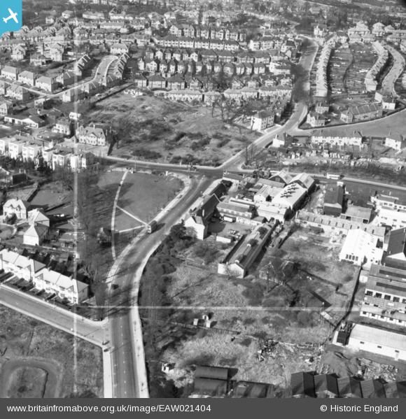
EAW021404 ENGLAND (1949). The junction of Church Lane and Kingsbury Road, Kingsbury, 1949. This image has been produced from a print marked by Aerofilms Ltd for photo editing.
© Copyright OpenStreetMap contributors and licensed by the OpenStreetMap Foundation. 2026. Cartography is licensed as CC BY-SA.
Nearby Images (8)
EAW021404

EAW021405

EAW021407

EAW021403

EAW021401
, Kingsbury, 1949. This image has been produced from a damaged negative.")
EAW021402

EAW021406

EPW024254

Details
| Title | [EAW021404] The junction of Church Lane and Kingsbury Road, Kingsbury, 1949. This image has been produced from a print marked by Aerofilms Ltd for photo editing. |
| Reference | EAW021404 |
| Date | 15-March-1949 |
| Link | |
| Place name | KINGSBURY |
| Parish | |
| District | |
| Country | ENGLAND |
| Easting / Northing | 520506, 188492 |
| Longitude / Latitude | -0.260573849443, 51.581913210672 |
| National Grid Reference | TQ205885 |
Pins

colsouth111 |
Monday 25th of April 2016 03:29:37 PM | |
|
The Laird |
Tuesday 24th of November 2015 06:51:53 PM | |
|
The Laird |
Monday 23rd of November 2015 08:48:22 PM |