
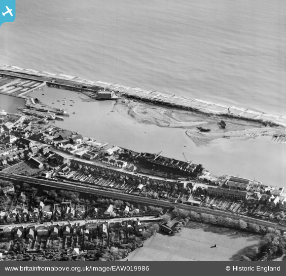
EAW019986 ENGLAND (1948). Turberville Wharf, Southwick, 1948
© Copyright OpenStreetMap contributors and licensed by the OpenStreetMap Foundation. 2026. Cartography is licensed as CC BY-SA.
Nearby Images (9)
EAW019986

EAW019981

EAW019983

EAW019985

EPW054049

EPW011519

EAW019987

EAW019982

EAW019984

Details
| Title | [EAW019986] Turberville Wharf, Southwick, 1948 |
| Reference | EAW019986 |
| Date | 19-October-1948 |
| Link | |
| Place name | SOUTHWICK |
| Parish | |
| District | |
| Country | ENGLAND |
| Easting / Northing | 524005, 104873 |
| Longitude / Latitude | -0.23900123858266, 50.829533039653 |
| National Grid Reference | TQ240049 |
Pins
Be the first to add a comment to this image!