
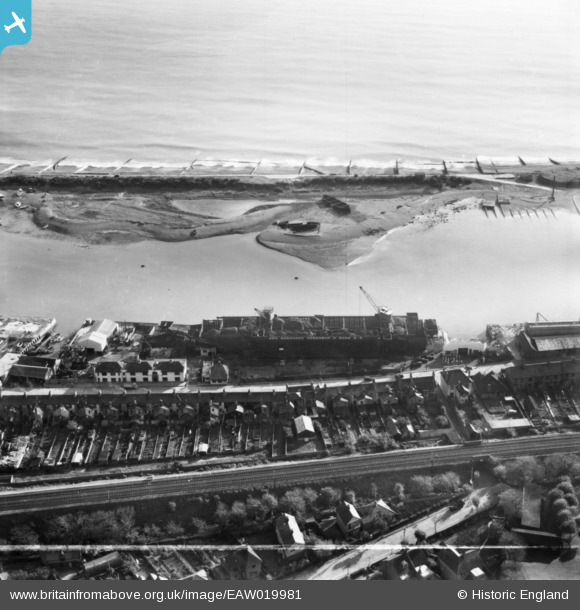
EAW019981 ENGLAND (1948). Turberville Wharf and Albion Street, Southwick, 1948. This image has been produced from a print marked by Aerofilms Ltd for photo editing.
© Copyright OpenStreetMap contributors and licensed by the OpenStreetMap Foundation. 2026. Cartography is licensed as CC BY-SA.
Nearby Images (8)
EAW019981

EAW019983

EAW019985

EAW019982

EAW019987

EAW019984

EAW019986

EPW054049

Details
| Title | [EAW019981] Turberville Wharf and Albion Street, Southwick, 1948. This image has been produced from a print marked by Aerofilms Ltd for photo editing. |
| Reference | EAW019981 |
| Date | 19-October-1948 |
| Link | |
| Place name | SOUTHWICK |
| Parish | |
| District | |
| Country | ENGLAND |
| Easting / Northing | 523889, 104931 |
| Longitude / Latitude | -0.24062812375069, 50.830079261951 |
| National Grid Reference | TQ239049 |
Pins

ALAN S |
Wednesday 10th of February 2016 07:48:55 PM |