
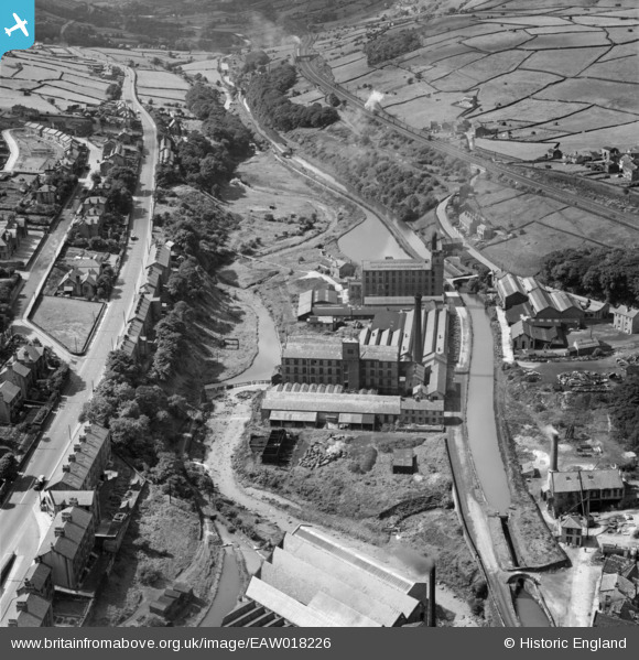
EAW018226 ENGLAND (1948). Upper Mill, Slaithwaite, 1948
© Copyright OpenStreetMap contributors and licensed by the OpenStreetMap Foundation. 2026. Cartography is licensed as CC BY-SA.
Nearby Images (7)
EAW018226

EAW018231

EAW018227

EAW018229

EAW018232

EAW018230

EAW018228

Details
| Title | [EAW018226] Upper Mill, Slaithwaite, 1948 |
| Reference | EAW018226 |
| Date | 18-August-1948 |
| Link | |
| Place name | SLAITHWAITE |
| Parish | |
| District | |
| Country | ENGLAND |
| Easting / Northing | 407662, 413786 |
| Longitude / Latitude | -1.8841516088137, 53.62032341744 |
| National Grid Reference | SE077138 |
Pins

Anthony Lockwood |
Wednesday 7th of October 2020 07:20:24 PM | |
|
John Wass |
Tuesday 24th of March 2015 09:06:27 PM | |
|
John Wass |
Monday 1st of September 2014 03:38:29 PM | |
 |
John Wass |
Wednesday 20th of August 2014 05:37:10 PM |