
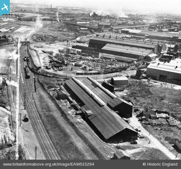
EAW015294 ENGLAND (1948). The Willenhall Foundry and environs, Willenhall, 1948. This image has been produced from a print marked by Aerofilms Ltd for photo editing.
© Copyright OpenStreetMap contributors and licensed by the OpenStreetMap Foundation. 2026. Cartography is licensed as CC BY-SA.
Nearby Images (11)
EAW015294

EAW015300

EAW015296

EAW015295

EAW015293

EAW015298

EAW015299

EAW015297

EAW015301

EAW000767

EAW047004

Details
| Title | [EAW015294] The Willenhall Foundry and environs, Willenhall, 1948. This image has been produced from a print marked by Aerofilms Ltd for photo editing. |
| Reference | EAW015294 |
| Date | 7-May-1948 |
| Link | |
| Place name | WILLENHALL |
| Parish | |
| District | |
| Country | ENGLAND |
| Easting / Northing | 397203, 298201 |
| Longitude / Latitude | -2.0412833220263, 52.581255568705 |
| National Grid Reference | SO972982 |
Pins

KevTheBusDriver |
Sunday 28th of June 2015 10:05:27 PM |