
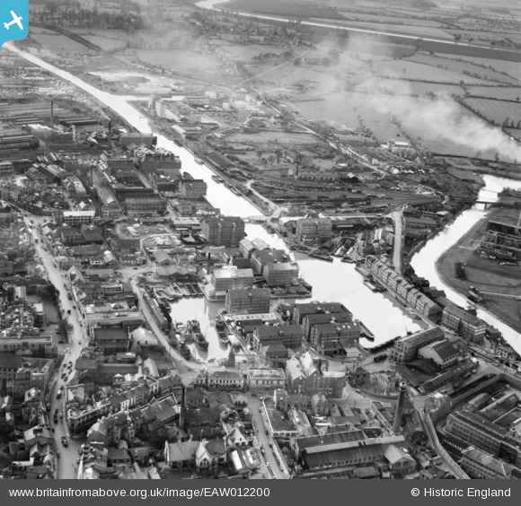
EAW012200 ENGLAND (1947). Gloucester Docks, Gloucester, 1947
© Copyright OpenStreetMap contributors and licensed by the OpenStreetMap Foundation. 2026. Cartography is licensed as CC BY-SA.
Nearby Images (22)
EAW012200

EAW012202

EPW037751

EAW012204

EPW037834

EPW037750

EPW037749

EPW024166

EAW012197

EPW048244

EAW012207

EAW012209

EAW021182

EPW024164

EAW012210

EPW024161

EAW021185

EAW018730

EAW021181

EAW021184

EAW021183

EAW012211

Details
| Title | [EAW012200] Gloucester Docks, Gloucester, 1947 |
| Reference | EAW012200 |
| Date | 13-November-1947 |
| Link | |
| Place name | GLOUCESTER |
| Parish | |
| District | |
| Country | ENGLAND |
| Easting / Northing | 382686, 218218 |
| Longitude / Latitude | -2.2514558642628, 51.861834762236 |
| National Grid Reference | SO827182 |
Pins

Sparky |
Saturday 30th of September 2017 08:48:35 PM | |

MB |
Wednesday 21st of September 2016 02:19:40 PM | |
|
MB |
Sunday 18th of September 2016 11:05:04 AM | |
|
MB |
Sunday 18th of September 2016 11:03:36 AM | |
|
MB |
Sunday 18th of September 2016 11:02:18 AM | |
|
MB |
Sunday 18th of September 2016 11:01:37 AM |