
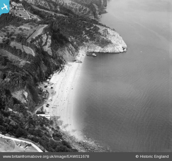
EAW011678 ENGLAND (1947). Oddicombe Beach and Petit Tor Point, St Marychurch, 1947
© Copyright OpenStreetMap contributors and licensed by the OpenStreetMap Foundation. 2025. Cartography is licensed as CC BY-SA.
Nearby Images (7)
EAW011678

EAW011677

EAW011675

EPW033711

EAW011676

EAW007659

EPW033406

Details
| Title | [EAW011678] Oddicombe Beach and Petit Tor Point, St Marychurch, 1947 |
| Reference | EAW011678 |
| Date | 6-October-1947 |
| Link | |
| Place name | ST MARYCHURCH |
| Parish | |
| District | |
| Country | ENGLAND |
| Easting / Northing | 292692, 66004 |
| Longitude / Latitude | -3.5127109609139, 50.483412693152 |
| National Grid Reference | SX927660 |
Pins

MB |
Friday 7th of February 2014 11:51:09 AM |
User Comment Contributions

Oddicombe Beach and the coast looking north east, Babbacombe, 08/07/2014 |

Class31 |
Saturday 9th of May 2015 08:01:18 PM |