
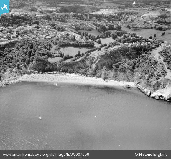
EAW007659 ENGLAND (1947). Oddicombe Beach, Torquay, 1947
© Copyright OpenStreetMap contributors and licensed by the OpenStreetMap Foundation. 2025. Cartography is licensed as CC BY-SA.
Nearby Images (7)
EAW007659

EPW033711

EAW011675

EAW011677

EPW033406

EAW011676

EAW011678

Details
| Title | [EAW007659] Oddicombe Beach, Torquay, 1947 |
| Reference | EAW007659 |
| Date | 17-June-1947 |
| Link | |
| Place name | TORQUAY |
| Parish | |
| District | |
| Country | ENGLAND |
| Easting / Northing | 292605, 65970 |
| Longitude / Latitude | -3.5139271680103, 50.483091059665 |
| National Grid Reference | SX926660 |
Pins

redmist |
Sunday 15th of January 2023 08:45:15 PM |
User Comment Contributions
We have seen the house on top of the hill and all the garden fall into the sea this year . |
RichW |
Friday 13th of December 2013 08:28:05 PM |