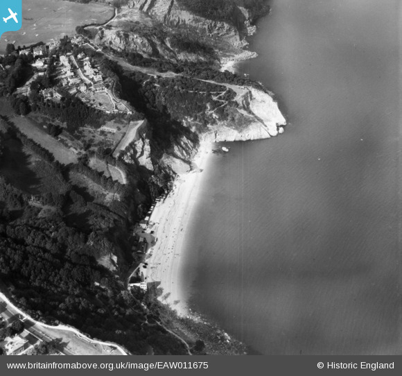
EAW011675 ENGLAND (1947). Oddicombe Beach and Petit Tor Point, St Marychurch, 1947
© Copyright OpenStreetMap contributors and licensed by the OpenStreetMap Foundation. 2025. Cartography is licensed as CC BY-SA.
Nearby Images (7)
EAW011675

EPW033711

EAW011676

EAW011678

EAW011677

EAW007659

EPW033406

Details
| Title | [EAW011675] Oddicombe Beach and Petit Tor Point, St Marychurch, 1947 |
| Reference | EAW011675 |
| Date | 6-October-1947 |
| Link | |
| Place name | ST MARYCHURCH |
| Parish | |
| District | |
| Country | ENGLAND |
| Easting / Northing | 292650, 66031 |
| Longitude / Latitude | -3.5133105655093, 50.48364775396 |
| National Grid Reference | SX927660 |
Pins

Class31 |
Saturday 9th of May 2015 07:56:00 PM |