
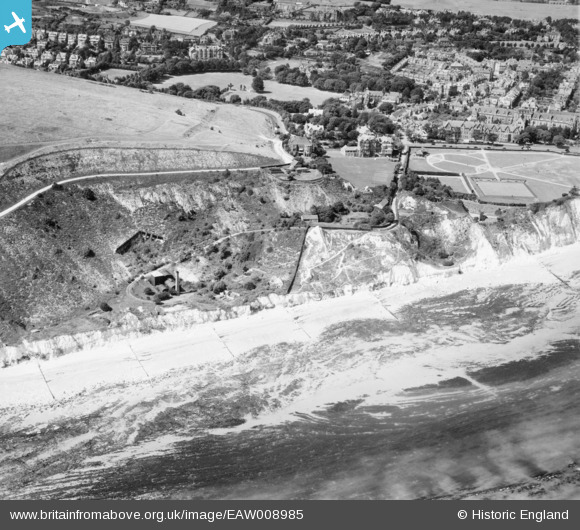
EAW008985 ENGLAND (1947). Holywell Mount and the coastline, Eastbourne, 1947
© Copyright OpenStreetMap contributors and licensed by the OpenStreetMap Foundation. 2026. Cartography is licensed as CC BY-SA.
Nearby Images (12)
EAW008985

EAW008984

EAW008987

EAW008983

EAW008988

EAW008986

EAW003106

EAW003108

EAW003105

EAW003109

EAW003107

EAW003110

Details
| Title | [EAW008985] Holywell Mount and the coastline, Eastbourne, 1947 |
| Reference | EAW008985 |
| Date | 12-August-1947 |
| Link | |
| Place name | EASTBOURNE |
| Parish | |
| District | |
| Country | ENGLAND |
| Easting / Northing | 560131, 96970 |
| Longitude / Latitude | 0.27019875361892, 50.749646178367 |
| National Grid Reference | TV601970 |
Pins

Paul C |
Tuesday 20th of January 2026 04:00:22 PM | |
|
Mikeo1938 |
Monday 6th of October 2014 02:19:42 PM | |
|
Mikeo1938 |
Monday 6th of October 2014 02:15:21 PM | |
|
Mikeo1938 |
Monday 6th of October 2014 02:13:37 PM |