
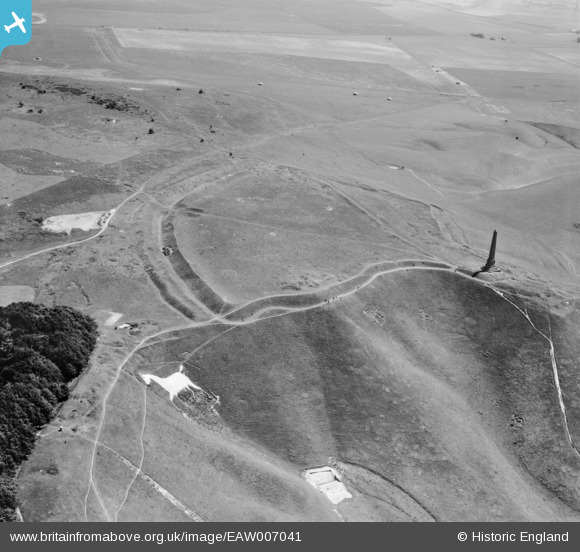
EAW007041 ENGLAND (1947). Oldbury Camp hillfort, the Cherhill Monument and the Cherhill White Horse, Cherhill, 1947
© Copyright OpenStreetMap contributors and licensed by the OpenStreetMap Foundation. 2025. Cartography is licensed as CC BY-SA.
Nearby Images (11)
EAW007041

EAW007040

EAW002273

EAW002274

EAW007042

EAW007039

EAW049157

EAW004158

EAW049155

EAW004159

EAW049156

Details
| Title | [EAW007041] Oldbury Camp hillfort, the Cherhill Monument and the Cherhill White Horse, Cherhill, 1947 |
| Reference | EAW007041 |
| Date | 11-June-1947 |
| Link | |
| Place name | CHERHILL |
| Parish | CHERHILL |
| District | |
| Country | ENGLAND |
| Easting / Northing | 404946, 169418 |
| Longitude / Latitude | -1.9288576427381, 51.423258221648 |
| National Grid Reference | SU049694 |
Pins

Class31 |
Tuesday 27th of October 2015 08:17:33 AM |