
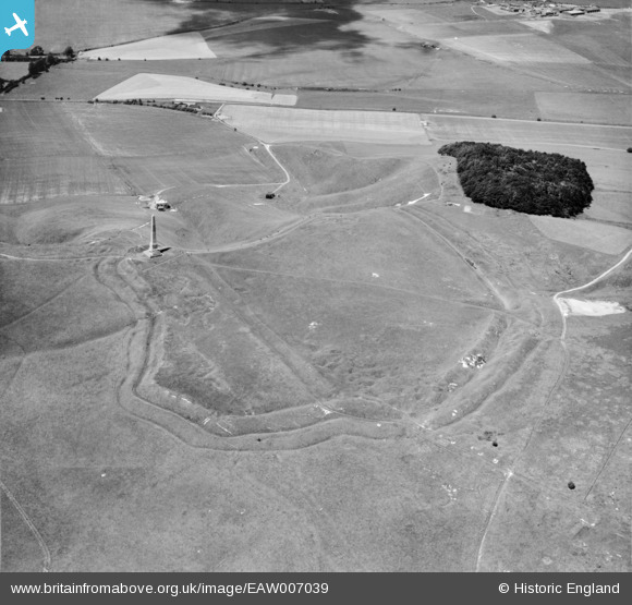
EAW007039 ENGLAND (1947). Oldbury Camp hillfort and the Cherhill Monument, Cherhill, 1947
© Copyright OpenStreetMap contributors and licensed by the OpenStreetMap Foundation. 2025. Cartography is licensed as CC BY-SA.
Nearby Images (9)
EAW007039

EAW049155

EAW049157

EAW049156

EAW007040

EAW007041

EAW002274

EAW007042

EAW002273

Details
| Title | [EAW007039] Oldbury Camp hillfort and the Cherhill Monument, Cherhill, 1947 |
| Reference | EAW007039 |
| Date | 11-June-1947 |
| Link | |
| Place name | CHERHILL |
| Parish | CHERHILL |
| District | |
| Country | ENGLAND |
| Easting / Northing | 404929, 169283 |
| Longitude / Latitude | -1.9291040458022, 51.422044366217 |
| National Grid Reference | SU049693 |
Pins
Be the first to add a comment to this image!