
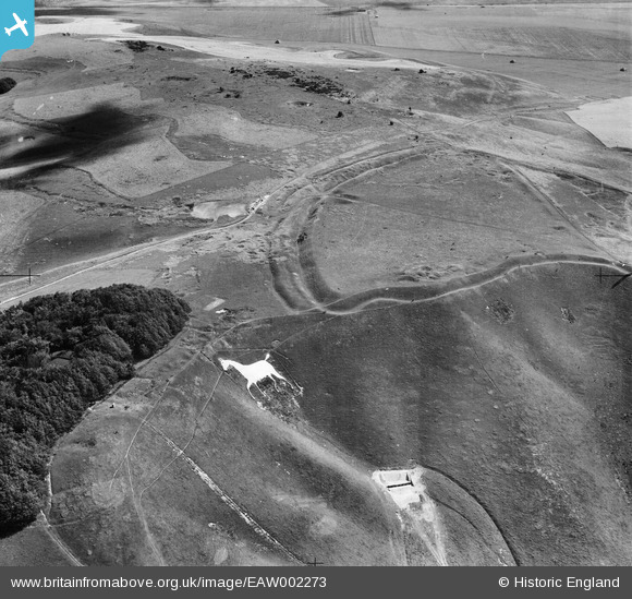
EAW002273 ENGLAND (1946). Oldbury Camp and the Cherhill/Oldbury White Horse, Cherhill Down, 1946
© Copyright OpenStreetMap contributors and licensed by the OpenStreetMap Foundation. 2025. Cartography is licensed as CC BY-SA.
Nearby Images (10)
EAW002273

EAW007041

EAW007040

EAW002274

EAW004158

EAW004159

EAW007042

EAW049157

EAW007039

EAW049155

Details
| Title | [EAW002273] Oldbury Camp and the Cherhill/Oldbury White Horse, Cherhill Down, 1946 |
| Reference | EAW002273 |
| Date | 18-August-1946 |
| Link | |
| Place name | CHERHILL DOWN |
| Parish | CHERHILL |
| District | |
| Country | ENGLAND |
| Easting / Northing | 404978, 169479 |
| Longitude / Latitude | -1.9283965037581, 51.423806491082 |
| National Grid Reference | SU050695 |
Pins
Be the first to add a comment to this image!