
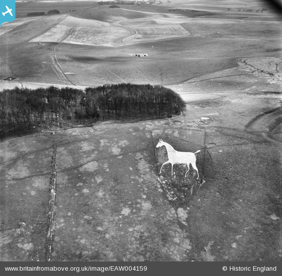
EAW004159 ENGLAND (1947). The Cherhill White Horse, Cherhill Down, 1947
© Copyright OpenStreetMap contributors and licensed by the OpenStreetMap Foundation. 2025. Cartography is licensed as CC BY-SA.
Nearby Images (7)
EAW004159

EAW004158

EAW002273

EAW007041

EAW007040

EAW002274

EAW007042

Details
| Title | [EAW004159] The Cherhill White Horse, Cherhill Down, 1947 |
| Reference | EAW004159 |
| Date | 10-April-1947 |
| Link | |
| Place name | CHERHILL DOWN |
| Parish | CHERHILL |
| District | |
| Country | ENGLAND |
| Easting / Northing | 405021, 169596 |
| Longitude / Latitude | -1.9277763342886, 51.424858247756 |
| National Grid Reference | SU050696 |
Pins
Be the first to add a comment to this image!