
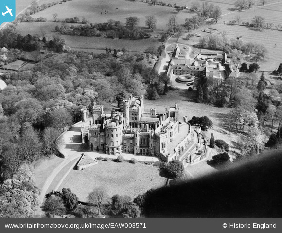
EAW003571 ENGLAND (1947). Belvoir Castle, Belvoir, 1947
© Copyright OpenStreetMap contributors and licensed by the OpenStreetMap Foundation. 2026. Cartography is licensed as CC BY-SA.
Nearby Images (10)
EAW003571

EAW013409

EAW013408

EAW013406

EAW013407

EAW005691

EAW005692

EAW005693

EAW005695

EAW005694

Details
| Title | [EAW003571] Belvoir Castle, Belvoir, 1947 |
| Reference | EAW003571 |
| Date | March-1947 |
| Link | |
| Place name | BELVOIR |
| Parish | BELVOIR |
| District | |
| Country | ENGLAND |
| Easting / Northing | 482021, 333722 |
| Longitude / Latitude | -0.78065070360662, 52.894360027871 |
| National Grid Reference | SK820337 |
Pins
 |

melgibbs |
Monday 16th of March 2015 10:38:47 AM |