
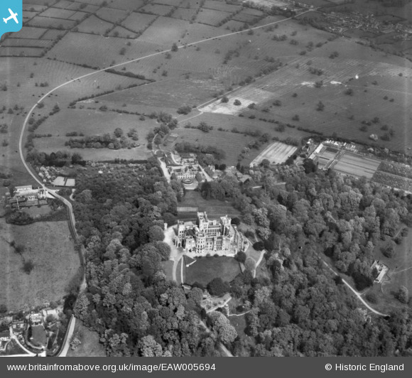
EAW005694 ENGLAND (1947). Belvoir Castle and the surrounding area, Belvoir, 1947. This image has been produced from a print.
© Copyright OpenStreetMap contributors and licensed by the OpenStreetMap Foundation. 2026. Cartography is licensed as CC BY-SA.
Nearby Images (5)
EAW005694

EAW005693

EAW003571

EAW013409

EAW013408

Details
| Title | [EAW005694] Belvoir Castle and the surrounding area, Belvoir, 1947. This image has been produced from a print. |
| Reference | EAW005694 |
| Date | 15-May-1947 |
| Link | |
| Place name | BELVOIR |
| Parish | BELVOIR |
| District | |
| Country | ENGLAND |
| Easting / Northing | 482238, 333851 |
| Longitude / Latitude | -0.7773928821555, 52.895486368811 |
| National Grid Reference | SK822339 |
Pins
 |

melgibbs |
Monday 16th of March 2015 10:36:27 AM |