
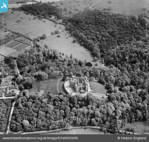
EAW005695 ENGLAND (1947). Belvoir Castle, Belvoir, 1947
© Copyright OpenStreetMap contributors and licensed by the OpenStreetMap Foundation. 2026. Cartography is licensed as CC BY-SA.
Nearby Images (9)
EAW005695

EAW005693

EAW013409

EAW013408

EAW003571

EAW013406

EAW005691

EAW005692

EAW013407

Details
| Title | [EAW005695] Belvoir Castle, Belvoir, 1947 |
| Reference | EAW005695 |
| Date | 15-May-1947 |
| Link | |
| Place name | BELVOIR |
| Parish | BELVOIR |
| District | |
| Country | ENGLAND |
| Easting / Northing | 482198, 333558 |
| Longitude / Latitude | -0.77806148379164, 52.892858905736 |
| National Grid Reference | SK822336 |
Pins
 |

melgibbs |
Monday 16th of March 2015 10:38:27 AM |