
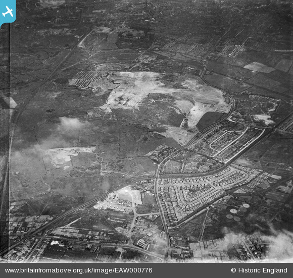
EAW000776 ENGLAND (1946). Industrial land adjacent to Wolverhampton Road and Bentley Cemetery, Bentley 1946
© Copyright OpenStreetMap contributors and licensed by the OpenStreetMap Foundation. 2025. Cartography is licensed as CC BY-SA.
Nearby Images (7)
EAW000776

EAW000772

EAW047013

EAW000770

EAW000773

EAW000774

EAW000771

Details
| Title | [EAW000776] Industrial land adjacent to Wolverhampton Road and Bentley Cemetery, Bentley 1946 |
| Reference | EAW000776 |
| Date | 11-May-1946 |
| Link | |
| Place name | BENTLEY |
| Parish | |
| District | |
| Country | ENGLAND |
| Easting / Northing | 398344, 298939 |
| Longitude / Latitude | -2.0244460179373, 52.587895487358 |
| National Grid Reference | SO983989 |
Pins

Bentleyboy |
Tuesday 8th of April 2014 05:57:00 PM | |
|
Bentleyboy |
Tuesday 8th of April 2014 05:54:50 PM | |
|
Bentleyboy |
Saturday 5th of April 2014 01:09:11 PM |