
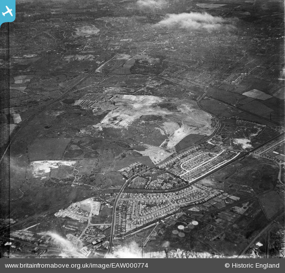
EAW000774 ENGLAND (1946). Industrial land adjacent to Wolverhampton Road and Bentley Cemetery, Bentley 1946
© Copyright OpenStreetMap contributors and licensed by the OpenStreetMap Foundation. 2025. Cartography is licensed as CC BY-SA.
Nearby Images (5)
EAW000774

EAW000775

EAW000778

EAW047013

EAW000776

Details
| Title | [EAW000774] Industrial land adjacent to Wolverhampton Road and Bentley Cemetery, Bentley 1946 |
| Reference | EAW000774 |
| Date | 11-May-1946 |
| Link | |
| Place name | BENTLEY |
| Parish | |
| District | |
| Country | ENGLAND |
| Easting / Northing | 398576, 298986 |
| Longitude / Latitude | -2.0210214159548, 52.588318714325 |
| National Grid Reference | SO986990 |
Pins

Bentleyboy |
Tuesday 8th of April 2014 05:59:53 PM | |
|
Bentleyboy |
Tuesday 8th of April 2014 05:58:23 PM |